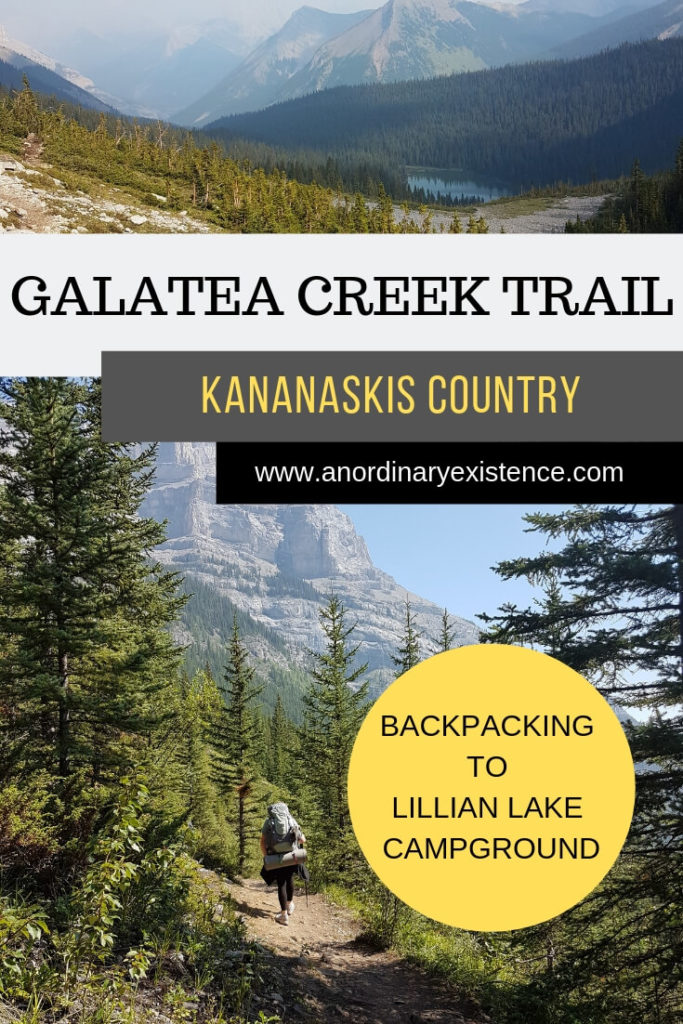
GALATEA CREEK TRAIL TRIP REPORT: BACKPACKING TO LILLIAN LAKE CAMPGROUND
The Galatea Creek Trail is located within Alberta’s Kananaskis Country, just a little over an hour’s drive from Calgary.
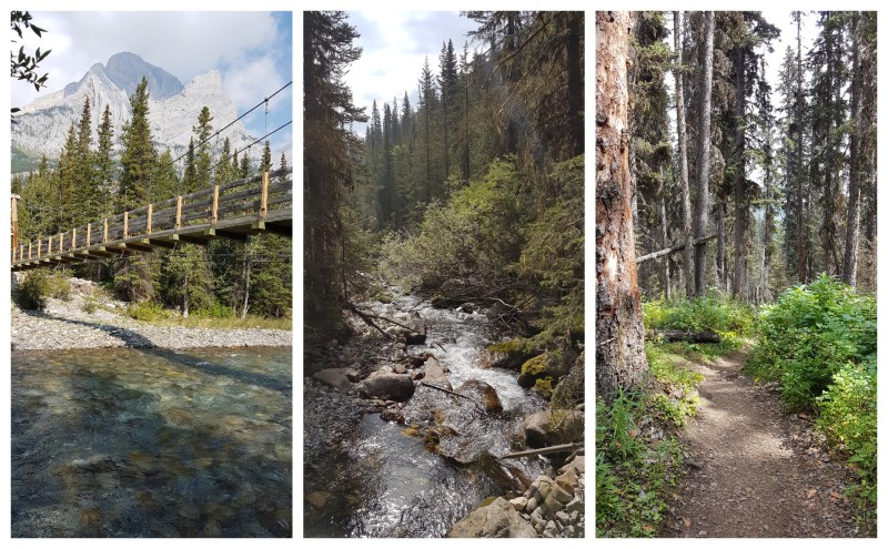
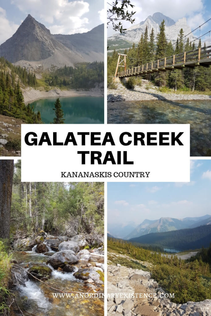
The trail starts at the Galatea Day Use Area, located along Highway 40, and winds its way along the Galatea Creek for 6.5 kilometers until reaching the Lillian Lake Backcountry Campground. Hikers can continue on past this point to upper and lower Galatea Lakes, another kilometer + past the campground.
This post may include affiliate links. As an Amazon Associate I earn from qualifying purchases. Find more info in my privacy policy.
This is one of the best Kananaskis hikes and can be done as a day hike or as a part of a backpacking trip.
I did this trail in August with 5 other women from my family, most of whom had never backpacked before. Although I hadn’t hiked this trail previously, I chose it because of its relatively short distance and beautiful looking campground. Despite the Alberta Parks description of the trail being “strenuous,” I figured it couldn’t be anything that bad. Any concerns I may have had were put to rest by reports of day hikers on All Trails who claimed the trail was “mostly flat” and could be done in 2 hours.
Once again, I had let myself forget that trail ratings are subjective and that day-hiking with the bare essentials is a completely different ballgame from carrying a full pack. The trail turned out to be harder than what any of us were expecting but we all made it and (I think!) I can speak for all of us and say it was challenging but fun trip.
HIKING THE GALATEA CREEK TRAIL
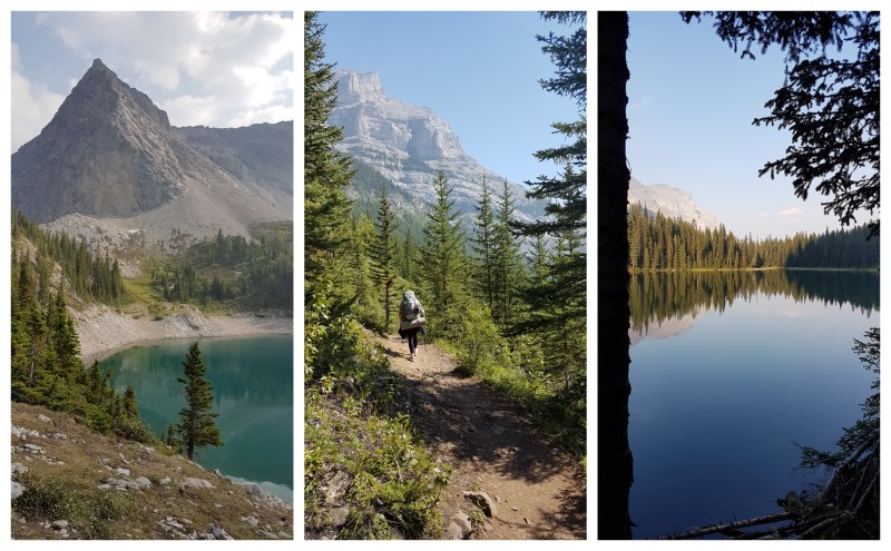
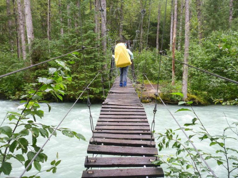
The trail starts off from the parking lot with a downhill section which eventually leads to the creek and the first of numerous bridges. The majority of the trail follows the same pattern: up and away from the creek, down and along the creek, across a bridge, repeat.
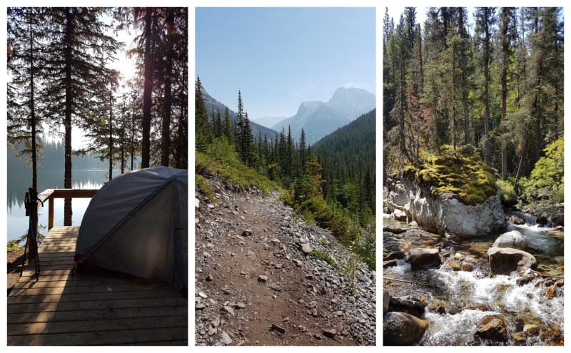
The trail generally moves in an uphill direction, with varying degrees of steepness (and thus varying degrees of burning legs and lungs under the weight of a heavy pack). There is a good mix of creek views, forest trails, and open mountain vistas. It really is a beautiful hike.
While the trail is well-marked at junctions and easy enough to follow, there are no distance markers and after a few hours we found ourselves wondering how much further we had to go. We knew that there was a steeper uphill section nearer the lake and every little hill had us thinking maybe that was it.
Which, of course, it wasn’t.
After crossing the final bridge, a friendly day-hiker on her way back down gently warned us that its “a bit of a slog” from there on and she was not wrong. This was by far the toughest uphill section of the trail and our tired legs made slow progress. After that it was a short section of flat trail to the campground where we were happy to drop our packs for the night. It had taken us about 4 hours to hike in.
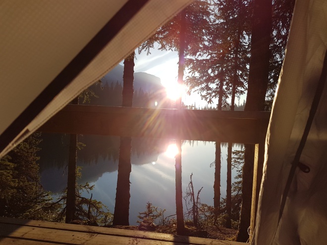
The view of the lake from our tent platforms did not disappoint.
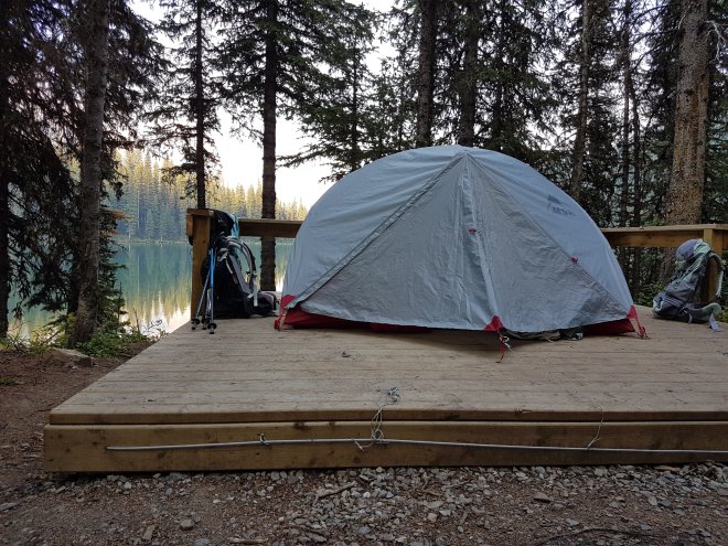
Our campsite at Lillian Lake
LILLIAN LAKE BACKCOUNTRY CAMPGROUND
The Lillian Lake Backcountry Campground has 17 tent sites, some of which are on wooden platforms and others with dirt tent pads. The sites are fairly spread out with some along the lake front and others further back.
There is one double outhouse with composting toilets which happens to be the best backcountry outhouse I’ve ever seen. There is also a communal eating area with picnic tables, two firepits, a waste water pit, and bear lockers.
After a taking a short break to set up camp and have a bite to eat, myself and one other member of our group decided we would try to tackle the trail to the Galatea Lakes. I had read that it was quite steep and I wasn’t sure if my legs had it in them to do another tough uphill climb but the trail reports also said it was totally worth it.
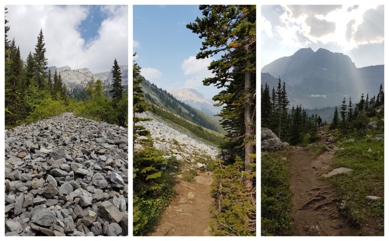
The trail certainly was steep and I took plenty of breaks as we moved along the switchbacks and up above treeline. From there the trail ran upward along loose rocky shale until we reached Lower Galatea Lake.
We both decided that we had had enough and wouldn’t try to go on to Upper Galatea Lake. We sat and looked out at the beautiful scenery before heading back down to the campground. I was slightly disappointed in myself for not making it to the next lake, but it just gives me a reason to go back again someday.
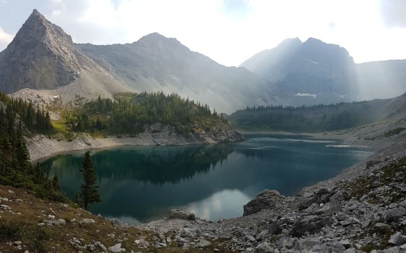
Lower Galatea Lake
We spent the evening in camp chatting with other backpackers around the fire and being entertained by a group of 12-13 year old boys on a camp outing who were also spending the night there. We all managed to stay warm in our sleeping bags despite the chilly 5-degree overnight temps.
After breakfast and coffee in the morning we packed up and headed back out along the same trail. The steep section just prior to the campground proved just as tricky in the downhill direction and 3 of us slipped and fell on the loose dirt. Thankfully we had no injuries and were able to continue on.
Coming back down and out felt much easier but the downhill sections still required careful foot placement and we weren’t a whole lot faster on the second day. It took us about 3.5 hours to hike back to the parking lot. That last little section of trail back up to the car was a cruel joke on tried legs but made getting there feel like a victory.
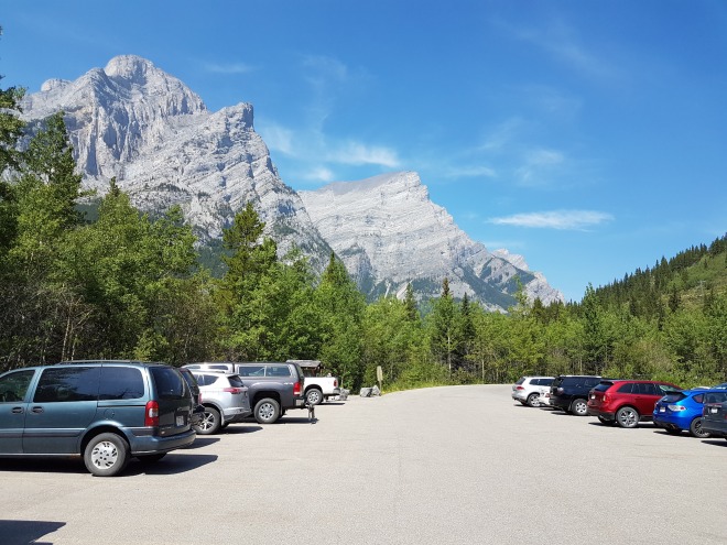
Galatea Creek Day Use Area
The Galatea Creek Trail is great for hikers looking to get a lot of variety in a fairly short distance. Keep in mind that carrying a full backpacking pack will make the trail a bit more difficult. Day hikers may find it easier on the legs, but the extra distance added by going out and back in one day would still make it a difficult hike (depending on fitness level, of course). If you are planning on hiking all the way to the Galatea Lakes, be prepared for a steep climb but rewarding views. For more info, check out the resources below.
RESOURCES:
Kananaskis Valley Trail Report
Lillian Lake Backcountry Campground
You can find more of my Kananaskis Country adventures here:
Kananaskis Country Trip Report
Lovely post and photos! My favorite hikes involve alpine lakes and this has inspired me to get out a few more times before Fall officially hits!
Thanks! It’s hard to believe summer is almost over already. Hope you get a chance to get out there a couple more times!
Looks lovely but that 4 hour hike would probably kill me. I’m not much of a hiker! The view was breathtaking.
It was a tough one! Especially with a full pack on – but the views were a great reward at the end 🙂
Do you know if the site locations were first-come-first-serve, or were the permits tied to specific site numbers?
Hi Ashley – at the time we hiked the trail, the sites were first-come, first-serve but I had heard that the next summer you could choose your site at the time of booking. I’m not sure how they’re running things this summer quite yet as it looks like reservations aren’t open. If the sites are tied to the permit this year, I highly recommend snagging a lake-front site if you can!