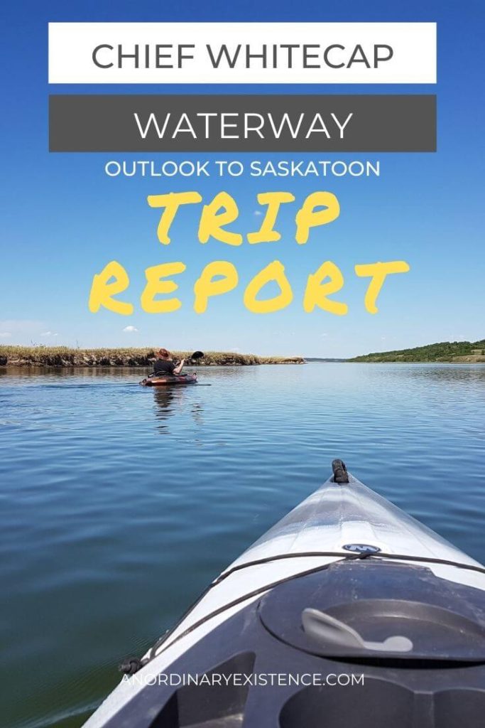
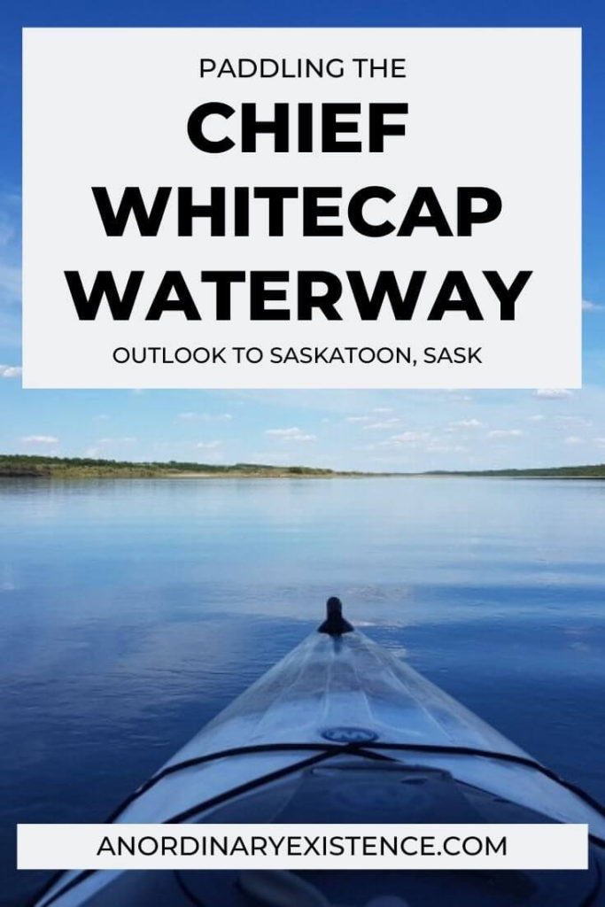
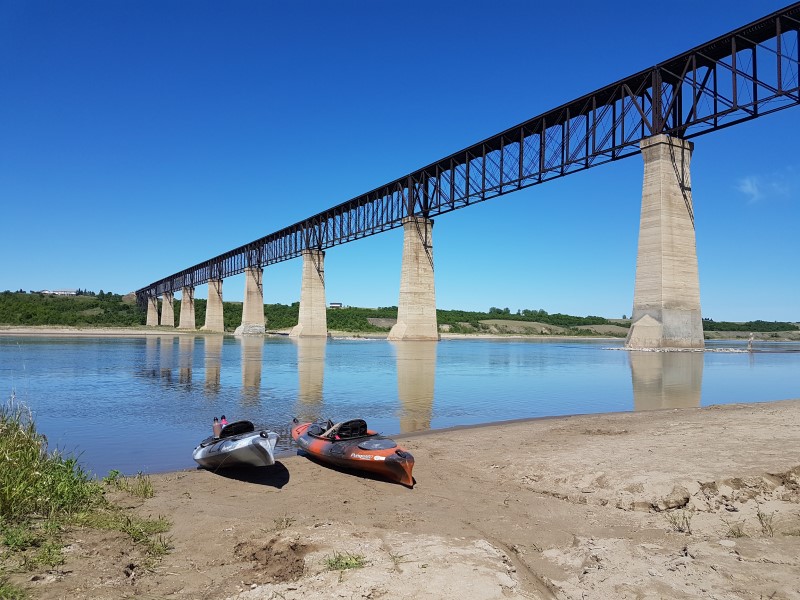
CHIEF WHITECAP TRIP REPORT: PADDLING FROM OUTLOOK TO SASKATOON
The Chief Whitecap Waterway is a water-based section of the Trans Canada Trail which runs from the Gardiner Dam at Lake Diefenbaker to the city of Saskatoon in Saskatchewan.
Mark and I kayaked about 100 km of the Waterway, from Outlook to Saskatoon, over three days. Below you will find photos, an overview of the trip, and all the information you need to do this adventure yourself!
This post may include affiliate links. As an Amazon Associate I earn from qualifying purchases. Find more info in my privacy policy.
Put in spot at Outlook Regional park
TRIP OVERVIEW
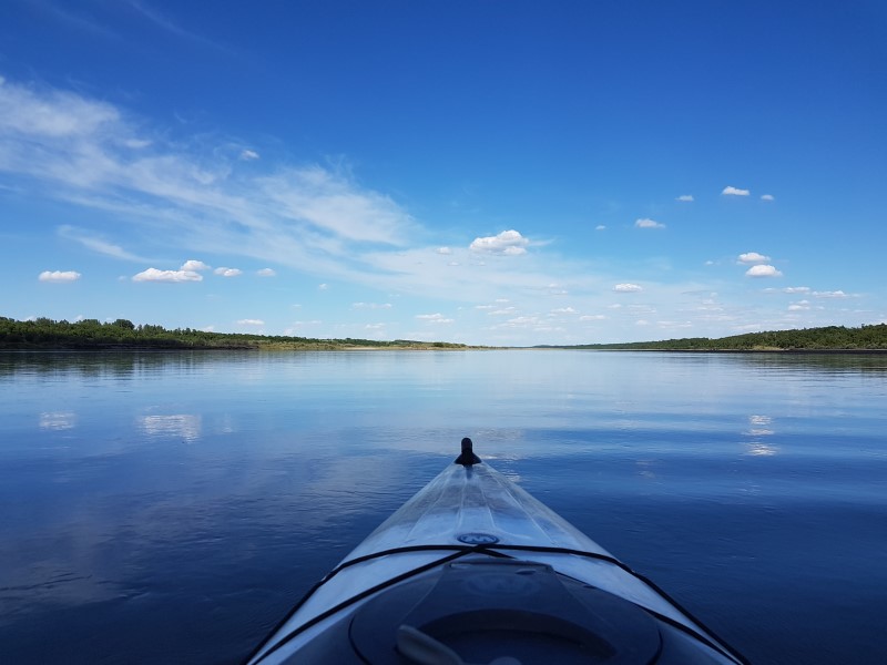
The total distance of the Chief Whitecap Waterway is around 125 kilometers and can be paddled in 3-5 days. The route is paddled with the current, in a south-to-north direction. This trip is a great option for those new to moving-water paddling as it lies along an easily navigable section of the South Saskatchewan River, does not include portages, and is rapid-free.
Because wild camping is allowed along the river, paddlers can pick and choose the amount of time paddled and distance covered each day. As long as there is a suitable spot to set up camp, you can practically stop at any point along the route.
Due to time constraints, we skipped the first leg of the route and put in at Outlook Regional Park, with a goal of arriving in Saskatoon within 3 days. We did this trip in June, while water levels were still relatively high and the current a bit faster. We found the trip to be easy in terms of navigation and paddling skills but did find the number of hours spent in our boats to be challenging. However, we enjoyed our time on the river and have plans to go back to complete the first section of the trail we missed. Below is a day-by-day breakdown of our trip.
DAY 1: OUTLOOK REGIONAL PARK TO CAMPSITE #1
Day one started with us driving to Saskatoon where we left a vehicle at our planned take-out point, Rotary Park. After that, we took a second vehicle to Outlook which is located about one hour south of Saskatoon via highways 219 and 15. Upon arriving at Outlook Regional Park, staff directed us where to park the car and access the river. The put in spot was a nice sandy area which made getting on the water extremely easy. We pushed off into the gentle current around 11:00 am.
We really lucked out with the weather on the first day and had a slight tailwind, nice sunny skies, and temperatures in the mid-20s (Celsius). However, we both slacked on reapplying sunscreen, which we would come to regret on the following days.
Since the water levels were relatively high while we were on the river, we only found ourselves hung up on barely-covered sandbars a few times. These sandbars can pose a problem during times of low water levels and force paddlers to get out and walk their boats over the most shallow spots.
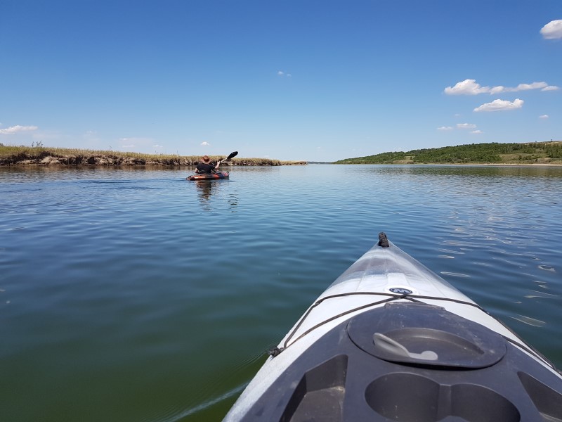
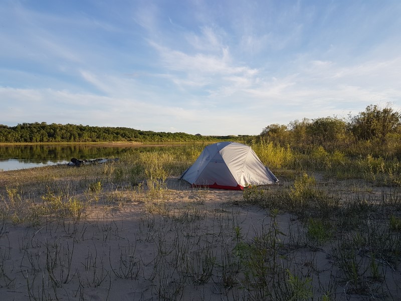
Neither one of us had been in our kayaks yet this paddling season and we had done little training beforehand, so I was a bit nervous about tackling a 100 km trip. We pushed hard on the first day to cover as much distance as we could as the forecast called for headwinds on the following days. We took few breaks and mostly just rested our arms while we let the current pull us down the river. By early evening we had both had enough for the day and started looking for a suitable campsite. We settled on a nice sandy spot on an island with enough trees to provide firewood.
We landed and went about our typical camp setup routine: pitch tent, cook dinner, filter water, build a fire. A quick jaunt into the trees in search of down and dead wood for the fire left us glad we set up camp in the sand rather than closer to the treeline, as Mark came out covered in ticks. Other than that, it was a nice evening as we rested our sore muscles and stretched our legs to get ready for day two.
Total Distance: 35 kilometers
Total Time: 6 hours
DAY 2: CAMPSITE #1 TO CAMPSITE #2
I found our second day on the water to be much more difficult than the first. It wasn’t so much that the paddling conditions were different but that I was a bit sore and let myself get mentally overwhelmed by the distance we were hoping to cover. We had set the goal of making it past the Berry Barn on day two which meant we had to paddle at least 40 km.
We battled a slight headwind heading out from camp and I was forced to cover up with long sleeves to protect my sunburned skin. A few hours into paddling I found myself frustrated, uncomfortable, and doubting if I would even be able to complete the trip. We decided it was time for a longer break to reset for the rest of the day. We landed on a small sandy section of riverbank and climbed out of our boats. We walked around, stretched, ate, and I took a minute to get my head right before heading out again. I also threw my camp pillow on my kayak seat to help with my sore bottom.
The food and pillow must have done the trick because I felt much better once we were out paddling again. We headed into a section where the river meanders back and forth through the valley. The riverbank got steeper and the trees larger and more mature than the brush we had mostly been through up until that point. It ended up being my favorite section of the river.
At the end of the twists and turns in the river lay the Berry Barn and our goal distance for the day. We paddled for another 45 minutes or so past that before finding a good campsite and landing for the final time that day. We were both exhausted and quickly set up camp so we could rest for the night. Shortly after eating a quick meal the skies darkened and some ugly clouds moved in. Luckily, they brought nothing more than wind and rain but the storm chased us into the tent for an early night.
Total Distance: 45 kilometers
Total Time: 9 hours
DAY 3: CAMPSITE #2 TO SASKATOON
Our hard work on the first two days paid off on day three. Setting off into a strong headwind, we were glad that we had put in the hours we had the day before so that we had a lot less distance to cover. The wind was particularly bad in the section that runs along Riverside Estates and we found ourselves having to paddle hard in order to make progress.
After the final bend in the river, the effect of the wind lessened and paddling got a little easier. We caught our first glimpse of Saskatoon and decided to take a break, slow down a bit, and enjoy the last stretch of river. We made our way into the city and it was neat to see it from a whole new perspective. We landed on a small sandy section at Rotary Park, just past the Idylwyld Bridge, which we had scoped out when we left a vehicle there. From there it was just a short scramble up the path to the parking lot where we unloaded the gear and got the boats on the roof rack.
As usual, it was a little bittersweet to come to the end of the trip. On one hand, we were both sore and tired and regretting having not trained beforehand. But at the same time we were just getting into a groove and would have like another day or two on the river. Overall, we were very happy with the trip and would highly recommend it to anyone looking for an adventure.
Total Distance: 17 kilometers
Total Time: 3 hours
MUST-KNOW INFO
If you are looking to do this section of the trail yourself, the information and resources below will help with planning and prepping for your trip.
PARKING/SHUTTLES
There are a few options for take-out spots located within Saskatoon. These include the dock at the Victoria Boathouse, Gabriel Dumont Park, and Rotary Park. Going off a recommendation from staff at a sporting goods store, we chose to leave a vehicle at Rotary Park. The lot is not secured and vehicles are left at your own risk.
If you have access to two vehicles, you can do as we did and leave a second vehicle at the Outlook Regional Park. We paid $24 for a 3-day vehicle pass to access the park. Other options would be to have someone drive you to the put in spot or hire a shuttle. Shuttle service from Saskatoon is provided by CanoeSki. If you are doing the entire trail and putting in at the Gardiner Dam, vehicles can be left at the Visitor Information Center.
WATER LEVELS
Water levels along this section of the South Saskatchewan River are controlled by the outflow of the Gardiner Dam and can vary greatly depending on the time of year and when the dam is opened and closed. As mentioned, lower water levels mean you may run into shallow sections where it is necessary to get out and walk your boat more often. High water levels can mean stronger currents and more debris in the river. Although this is a very good “beginner” section of the river, extremely high water levels should be approached with caution. You can find more about flow rates on the South Saskatchewan here (right-hand side of the homepage).
CAMPING
According to the Chief Whitecap Waterway website, there are designated rest areas complete with picnic tables and firepits available along the route which are available to paddlers for camping. However, in our three-day trip we didn’t see a single rest area so either they aren’t there, or we weren’t paying enough attention. Wild camping is available along the riverbank and there are plenty of sandy areas to set up camp, although there are a few stretches where landing/camping isn’t as desirable.
Because water levels can change quickly once the dam is opened, be sure to camp well away from the shoreline or you might wake up to an unpleasant situation. I recommend camping on one of the larger islands with bigger trees for shade and firewood. As always, be sure to follow leave no trace rules when wild camping.
GEAR
Canoes, kayaks, and stand-up paddleboards can be rented from a number of places in Saskatoon including from CanoeSki.
Besides a watercraft, paddlers will need mandatory safety equipment, clothes, food, a water treatment system, and basic backcountry camping gear. Cell service is spotty at some points along the trail but is available in most areas. I found it useful for checking our location on Google Maps to see the progress we were making.
RESOURCES
Map of the water trail.
Chief Whitecap Waterway Website
Gardiner Dam Information Center
South Saskatchewan River Water Levels